


Briey en famille

fizz1212
User
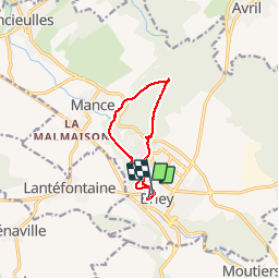

Length
8.1 km

Max alt
308 m

Uphill gradient
169 m
Km-Effort
10.3 km

Min alt
204 m

Downhill gradient
161 m
Boucle
Yes
Creation date :
2019-08-07 07:50:56.649
Updated on :
2019-08-07 10:27:57.077
2h21
Difficulty : Easy

FREE GPS app for hiking
 SityTrail
IGN / Geographical institutes
SityTrail Plus
The world is yours!
About
Trail Walking of 8.1 km to be discovered at Grand Est, Meurthe-et-Moselle, Val de Briey. This trail is proposed by fizz1212.
Description
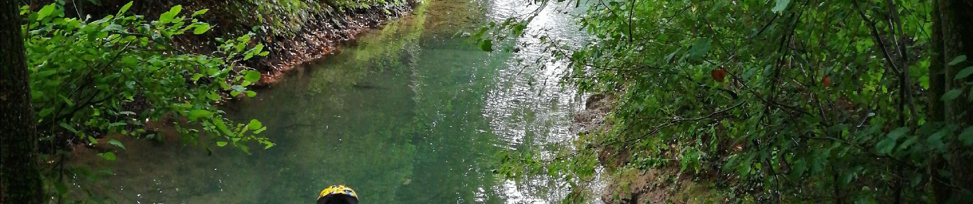
À la découverte de Briey par la forêt, la rivière et la réserve naturelle.
Photos


Positioning
Country:
France
Region :
Grand Est
Department/Province :
Meurthe-et-Moselle
Municipality :
Val de Briey
Location:
Unknown
Start:(Dec)
Start:(UTM)
713538 ; 5459204 (31U) N.
Comments